Apple Maps just doesn't cut it for everyone, so there is a rich market of GPS alternatives for the iPhone. Many are good. In this review we test Google Maps for iOS, Navigon USA, Gokivo, MapQuest, Scout, Nokia HERE Maps, Waze and even Apple Maps.

Word on the street is that Apple Maps leaves everything to be desired... still. Some of the errors in its satellite views and routing instructions are serious. Some have been classified as life threatening, especially in Australia where iOS users have been strongly urged by national and regional law enforcement to use another product so they don't get lost in deserted areas. Other users, in other parts of the world, aren't bumping into the problems.
![]()
This leaves those of us who are chronically, directionally challenged with a bit of a dilemma on the iOS side of the world – which GPS app should I use on my iPhone (or mobile broadband enabled iPad)? Thankfully, there are a number of different GPS apps available in the iTunes App Store. Last year's roundup addressed the lack of a native navigation tool in Apple's mobile OS. This year, I hope to explain why Apple Maps 1.0 became infamous and what Apple must do to fix it; as well as identify some new navigational choices. You will see one or two apps from last year make a second appearance due to major programmatic updates.
First, let's talk about the different type of GPS apps on the market. There are currently three different kinds. A brief description of each can be found below.
Maps on Board — When cell signals are in short or spotty supply, the Maps on Board GPS app like TomTom USA is what you need. With a GPS app of this type, all you need at that point is open sky...and about 1.5GB of free device space, as the app and its data come over as a single component. You are free and clear to navigate with or without a mobile broadband signal.
Maps on Demand — When storage space is at a premium and you're in an area with solid mobile broadband coverage, a GPS app that provides map data as you move into a specific geographical area gets the job done without eating up a gig and a half of space. As long as you have at least a 3G signal on your device, it should be able to access the appropriate map data it needs to get you safely and accurately to your destination with always the latest version maps at your disposal.
Hybrid (Download and Retain Regional Data) — For those times when a little bit of both is needed – cell coverage is spotty and you don't have a lot of device space to give up, but can spare just the right amount to the task, a hybrid solution provides the best of both worlds. This uses up bandwidth only when it needs to download new data, but will likely only eat up 250-500MB of storage at a time. Most users blow that much or more just by having Facebook on their iDevice.
Secondly, I'd like to say something about map data, map subscriptions and in-app purchases.
Only as Good as the Data — As with Apple Maps, it really doesn't matter how awesome the program or its UI are. Mapping and navigation apps are only as good as the data they provide. If the built-in info is bad, the app is going to be abysmal, no matter who wrote or published the thing.
Map Subscriptions are a Good Thing — If you like an app, purchasing a map subscription is likely a good idea. With a data subscription, you're always going to have the latest and greatest on-board maps at your disposal. However, updates to Maps on Board apps will likely be large, and you may need to wait until you have a reliable Wi-Fi signal to download the update.
Roads change all the time. Instead of waiting 2-4 years to issue a new set of maps like many companies used to do at the early days of consumer GPS, a map subscription can get your local, regional or national OTA updates as often as once a month to a couple times a quarter.In-App Purchases Equate to Margin Dollars — Most apps that have map and/or data subscriptions (these include traffic and radar/red light cameras) offer them via in-app purchase. In many cases, Navigon excluded (as far as this roundup is concerned), the app is either offered for free or at a nominal price. Map and other in-app purchases that make the app truly functional are offered to you after you download and install the app.
Unfortunately for developers, Apple takes the same 30-percent cut of all in-app purchases as it does with App Store purchases. But at least the app vendor has the user locked into the app and can offer additional functionality as long as it's compliant with Apple's In-App Purchase Guidelines.
I'd also like to remind everyone that distracted driving is a definite no-no. If you do use any kind of GPS device or navigation application on your iPhone or other smartphone, please make sure that you download apps and set up your phone for navigation before you start driving.
All screen shots associated with this roundup were taken while I was a passenger in a moving vehicle.
Next Page: Google Maps for iOS
(Click image for a larger version)
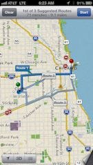
 Route alternatives
Google Maps has been on iOS devices everywhere for years; but as a mapping solution only. It made last year's round up, but as an Honorable Mention only.
Google Maps has been a staple on the Android side of the fence for years. In fact, it's so good, that there really isn't any need to buy or use any other navigation program on your Android device, provided you have what you need for a Maps-on-Demand app – 3G or better mobile broadband.
On the iOS side of the world, Google Maps is now also one of the BEST navigation apps in the App Store. The app was downloaded over 10-million times in the first 48 hours of its initial release. I think that speaks more to Google Maps' strengths rather than Apple Maps' weaknesses.
Google's strength is search, and Google Maps for iOS does local search very well. Google learned a lot about navigation from its integration as part of the Android operating system and they have brought some of that expertise to your iPhone or mobile broadband-enabled iPad. Simply put, this is an awesome app, and if you know you're going to be in an area with decent mobile broadband coverage and need a navigation app, Google Maps for iOS is an awesome choice.
I've used the app on both platforms. It functions the same way on both iOS and Android devices. Maps are clear and detailed; and its voice guided navigation is clear, well timed, and easy to understand. It's one of the best navigation apps I've ever used on ANY mobile platform.
Synching with your Google Account brings in all of your navigation history and favorites. If you've used Google Maps before, you're going to be able pick up right where you previously left off. The only thing missing is integration at the OS level, which might come with the release of iOS 6.1; but that is yet to be seen as of this writing.
Click here for Google Maps for iOS (US) on iTunes
Click here for Google Maps for iOS (Europe) on iTunes
Price: Free
App Type: Maps on Demand
(Click any image for a larger version) |
|
(Click image for a larger version)
Route alternatives
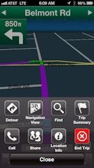
Navigon USA is a Garmin powered GPS app, and Garmin's experience and influence shines through here. The app is visually pleasing and provides a lot of information. Street names are clearly labeled throughout the display, and update at an appropriate interval once you approach their location.
As with the other apps in this year's roundup, Navigon handles local search well. Items of interest – restaurants, shopping centers, public parking, ATMS, etc. show up as you approach them. Their location is clearly shown but unfortunately, next to all of the local street names, visual directional cues as well as accurate lane visuals and speed limit signs, the display can become quite cluttered. You can control this to some degree in Preferences, but shutting some of the information off can decrease the visual value the app provides. Unfortunately, the screen clutters in both portrait and landscape orientation.
However, once you're on the road, the app really shines. Maps are detailed. The animation is smooth. During navigation, the app displays your current speed, ETA, remaining trip distance, distance to your next navigational change and the upcoming street or exit name.
When you use Navigon's Cockpit, one of its more interesting plug-ins, you also get three very interesting views: G-Force, Elevation and Direction and Speed over Trip Duration. The information is pretty cool and informative. The Elevation and Direction screen probably provides the best overall information when you're on a pretty straight or long interval section of a particularly long trip.
Navigon USA is probably the most expensive GPS app I've ever used; but it's also one of the best Maps-on-Board apps you're going to come across. If Google Maps isn't your app of choice, or if you're going to be in an area where you know mobile broadband coverage is going to be weak, this is one of the best apps to get.
Click here for Navigon (US) on iTunes
Click here for Navigon (Europe) on iTunes
Price: App - $49.99, Navigon Fresh Maps 1 yr. - $39.99, Navigon Radar Info US 1 yr. - $0.99
App Type: Maps on Board (data downloaded after app purchase)
(Click any image for a larger version) |
|
(Click image for a larger version)
 Current location
Gokivo is an interesting GPS navigation app for iOS from Networks In Motion. The last major update the app got was back in 2009. Since then, the app has changed a great deal, and for the better I might add.
Gokivo offers both basic and 3-D turn-by-turn navigation on your iPhone, offering both spoken directions and street names as well as real highway signs and road views. Its monthly and yearly subscription prices for both its basic and enhanced 3-D navigation include automatic provision of updated maps via your carrier's data plan or local Wi-Fi signal.
The app supports social networking features via Facebook. It will post your location via FB check in to your Timeline. Like FourSquare, this is good and bad, as it lets others – read your local criminal element – know that you aren't home, so exercise caution when posting data of this type. It's also not a great idea to network on Facebook while you drive. If you must check in somewhere, please do so after you are done driving.
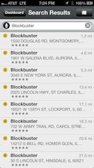
The app has support for local search so that you can find movie theaters, gas stations, local events, etc., near your current location. Gokivo can do this via text as well as voice input. Though it does local search very well, that's not the app's strongest point. The app is very good at multitasking, giving you the ability to control and listen to your favorite audio app while continuing to receive audio directions in either English or Spanish.
I found the app and its 3-D navigation interface to be a bit clunky, however. I really hate the cutesy car icon that it uses to illustrate your location. I was much happier with the blue dot in other screens.
The app also REALLY wants you to stick to the route it plans for your trip, using the data it has. If, for example, you're on a road that is close to, but not part of its current map, the app will only reroute you so many times before it finally assumes you're off road and don't want to go to your destination. The app doesn't quit, but will cancel your planned route, leaving the displayed map on your iPhone's screen.
This was the app's fatal flaw for me. Any app that I use, especially a GPS app, shouldn't assume that I want to cancel a trip whether I'm on route or not. Even a GPS app that delivers Maps on Demand may not have the latest road schematic, especially in newer residential areas. Making an assumption that I'm off-road and don't want to go to my planned destination and auto killing the navigation session isn't acceptable.
Click here for Gokivo on iTunes
Price: App is free, Basic Navigation is $0.99/mo. or $9.99/year; 3D navigation is $4.99/mo., $19.99.year
App Type: Maps on Demand
(Click any image for a larger version) |
|
(Click image for a larger version)
Local attractions
At one time, MapQuest was THE online destination for written directions when you needed to go out and about. Some eight to ten years later, I still have friends and family who want to Map Quest their way from one place to another despite the fact that they have a smartphone with a navigation solution already on it, or just a few taps away.
Today, MapQuest for iOS is an OK navigation app for your GPS-enabled device. It provides 2-D navigation and is missing the 3-D navigation as well as the 3-D lane assistance that is now becoming common in other apps. Unfortunately, it's also ad funded and a small part of your screen is given over to rotating banner ads. I'm not single, and if I was, I wouldn't be interested in match.com while I drive. A better ad strategy would be to wait until I searched for a local business, and then showed me ads from the business I searched for or from similar local businesses. Match.com has nothing to do with the restaurant or gas station I'm currently searching for.
The screen provides decent information while navigating, aside from the reappearing/disappearing banner ads, and its voice guided navigation isn't bad. I was. however, a bit surprised to find that zoomed-in maps were a bit blurry the closer to the street you got. For a moment, I thought it might be me, my new glasses or bad eyes. Its GPS accuracy, the closer you got to full magnification, decreased. Street text labels also got nearly too small to read at full magnification.
When compared to Google Maps, or even Apple Maps, both of those seem to be more sophisticated, better functioning applications, providing a better, overall navigation experience than MapQuest. When compared to Google Maps specifically, Google Maps seems to wipe the floor with MapQuest for iOS. However, it's still a decent choice; and the price is right, especially if it's something you're familiar with from the PC side of the world.
Click here for MapQuest on iTunes
Price: Free
App Type: Maps on Demand
(Click any image for a larger version) |
|
(Click image for a larger version)
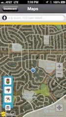 Local scenery
Scout is a Telenav app. Telenav, as you may recall, is one of the best veteran GPS navigation vendors out there. Many carrier-branded, subscription-based Map on Demand apps have been Telenav powered. You may have used one. I did while with AT&T for more than a couple years.
Scout is a decent navigation app. Its routing is accurate and its voice prompts come at just the right distances to make you aware of pending direction changes. As you can see from its screen shots, the interface is clean and well organized. Its concentrations on navigation via local search plays well with what it was named to do – scout out the local area and help you find your way to the places you're looking for.
While its navigation is good, its 2D display is better than its 3D, in my opinion. I had trouble discerning the two from one another. The version I pulled out of the App Store also wasn't optimized for iPhone 5 or its bigger screen, though that was changed with an update released in January of 2013. Scout also doesn't provide walking or transit directions or display speed limit signs.
However, I was very pleased with the way it handled the navigation tasks I gave it. It was able to find the destinations I was looking for via its local search functions and then got to those destinations without a hitch.
The app is free and provides all services for free in a Maps on Demand presentation. If you want better mapping performance or know you're going to be in an area where a reliable mobile broadband connection may not be available, it does support Maps-on-Board via a $24.99 annual subscription to Scout Plus.
Click here for Scout (US) on iTunes
Click here for Scout (Europe) on iTunes
Price: Free, Scout Plus - $24.99 in-app map subscription
App Type: Hybrid
(Click any image for a larger version) |
|
Next Page: Honorable Mention — Apple Maps
Honorable Mention — Apple Maps
(Click image for a larger version)
 Satellite Images
Apple Maps was introduced with the release of iOS 6 and the coverage of its gimps and glitches are well known. The issues currently encountered by the app led to Scott Forestall's departure from Apple and a public apology from Tim Cook. BYTE's Editorial Director, Larry Seltzer seems to think that the damage done to Apple Maps by all the errors, issues and bad press is irreparable.
I'm not certain I agree. I think recovering from Apple's current, perceived level of quality is possible; but will require a complete overhaul of the app. It will definitely require a full version rev (from 1.0 to 2.0) and not an evolutionary, gradual change over the next few iOS releases, which is Apple's current M.O. with most of its apps and products. They need to correct the problems with the app immediately, or else they need to pull it.
...And pulling it would be a shame. The UI for the app is really rather elegant. If data for your current geographical area is correct and/or reasonably accurate, you should have no problem using Apple Maps to get around town or to do local search. The problem comes when your area's data is not up-to-date. Unfortunately, right now, it's a crap shoot at best, as there's no way to tell without actually trying to find the Golden Gate Bridge or Statue of Liberty that they've actually melted, at least according to Apple Maps.
Click here for the Apple Maps home page
Price: Free
App Type: Maps on Demand
Included with iOS 6.x
(Click any image for a larger version) |
|
Next Page: Honorable Mention — Waze
(Click image for a larger version)
Welcome to Chicagoland
As I stated last year, Waze is part game, and part serious navigation app. Though it got its start in the Android world, it got noticed and made the jump to iOS. Since the Apple Maps debacle, it's become very popular with iOS users too. Waze enlists you, the user, to help validate its on-demand maps. In return for using the application and "road munching"-— gobbling up dots on unvalidated roads Pac Man style — you earn game points you can track. Waze takes the validation data and uses it to confirm that its cartography data is accurate. Users also get points for reporting accidents, speed traps, police cruiser locations, and other road happenings.
Although Waze does provide turn-by-turn navigation, and does a good job of getting you from point A to point B, the road-munching game gets to be a little tiresome after the novelty wears off. Also, for an app that displays a distracted-use warning on first startup, Waze requires way too much interaction from the driver during use. For serious or ongoing navigation needs, you should look elsewhere — unless you rely on a passenger to assist you with your driving.
Click here for Waze on iTunes
Price: Free
App Type: Maps on Demand
(Click any image for a larger version) |
|
Next Page: Honorable Mention — Nokia HERE Maps
Honorable Mention — Nokia HERE Maps
(Click image for a larger version)
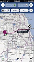 Routing
Nokia HERE Maps is an iOS 5.x and earlier Google Maps replacement. It made a huge splash back when it was originally released late in 2012. The big thing here is that it is nearly an identical replacement for what Google previously provided and Apple removed with the introduction of iOS 6.
It does local search and it also provides driving, walking and transit directions for iPhone users. However, it does not do turn-by-turn directions. So, nice try Nokia, but with the new Google Maps for iOS now available for download, Nokia HERE Maps really doesn't provide the value it did at its initial release. Heck, I'd even take Apple Maps over Nokia HERE Maps at this point, even with its issues. At least the turn-by-turn navigation part is sorta-kinda accurate, but again, your mileage may vary.
Click here for Nokia HERE Maps on iTunes
Price: Free
App Type: Maps on Demand
(Click any image for a larger version) |
|
About the Author(s)
You May Also Like

