

Never Miss a Beat: Get a snapshot of the issues affecting the IT industry straight to your inbox.
Relaxed regulations and greater affordability soon could fill the skies with satellites put there to collect images and other data for businesses hoping to get a leg up on the competition.
8 Min Read


Steerage To The Stars: The Cheapsat Revolution
Steerage To The Stars: The Cheapsat Revolution (Click image for larger view and slideshow.)
If you made a list of recent and future catalysts of massive data growth, you'd probably jot down things like mobility, social media, machine data, the Internet of Things, and ... outer space?
What was once the purview of James Bond is increasingly accessible to private enterprises, which can now use satellite-generated information such as imaging and geospatial data for big data initiatives in market research and planning, supply chain and logistics, competitive intelligence, and other purposes.
Military and intelligence personnel have relied on satellite data for years to keep tabs on other nations and goings-on around the globe, but it was largely classified or otherwise restricted from the private sector. Now, looser regulations and lower costs are allowing companies to use that same kind of information for a variety of business reasons, such as near-real-time geospatial data visualizations of housing construction and other activity when planning new store locations.
"For years, this was all cut off [from the business world]," Thermopylae Sciences + Technology CEO A.J. Clark told us in an interview. For most people, the most obvious example of increased accessibility to high-quality space-based imaging is Google Maps or Google Earth. (Thermopylae was a 2013 Google enterprise global partner of the year for maps.) "The whole concept of having higher-resolution imagery is good when we just think about a user looking at a picture, but it's great, by an order of magnitude, when we start talking about running automated analytics against that imagery to develop answers to business questions," said Clark.
[Stop looking over your shoulder. Read Location Tracking: 6 Social App Settings To Check.]
Just as intelligence agencies have used such images to track, say, activity in and around a particular facility in another country -- the number of trucks that arrive and depart in a given time period for example -- private enterprises now can access similar information for monitoring, say, a competitor's manufacturing plant.
"[In] any manufacturing [business], there is now an ability to replicate that supply chain and every detail about how frequently components move as companies analyze their competitors," Clark said. "Being able to extract automatically the answers to questions about anything that can be visibly detected within a competitor's space -- it just represents a treasure trove of new information to make better business decisions off of."
Figure 1: 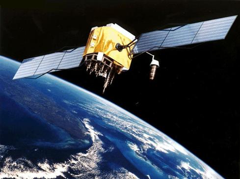
It's not just industrial spy games, either. The same principle could be applied inward to a company's own operations. Although corporations might do asset tracking on a narrower scale today -- GPS tracking of truck fleets, for instance -- they can now do much more by mapping and tracking all components of an end product through final delivery.
"You [can] spatially map your factory so as the part departs transits [between] different locations, you are alerted in real time where it's at, if it's delayed, if it went to the wrong place -- then as it's six hours from final production, you're sending an alert to your truck that's going to ship it to your retailer or to your end buyer that 'it's about ready to go, you guys should be teed up,'" Clark said. "The amount of time that is wasted in that entire supply chain, manufacturing, and delivery process is immense and we can be much more efficient."
Market research and analysis is another clear use for space-based imaging and geospatial data. Although tracking information such as population growth or new housing construction when determining whether to enter a new market
isn't a new approach, satellite-generated data can offer more detail in much shorter time windows.
"You can see real-time development of areas in the world, such as what housing areas are going up, which areas have more business, which areas have a higher density of buildings that are tall versus small," Clark said. "Is the distribution of potential customers in a city centralized because you have a lot of tall buildings, or decentralized because you have a lot of [short] buildings, and how is that growth occurring in real time?" Clark noted that such data and data visualizations can be analyzed in real or near-real time instead of waiting for manual reports compiled on an annual basis: "[You could receive] weekly updates so that you can tune exactly when you open that new Pizza Hut or Safeway in an emerging market."
Access to satellite-generated data isn't just a product of eased regulations, but also considerably lower costs compared with the days when satellite imaging and other data was the domain of the military and intelligence. Clark conservatively estimated that space-based imaging costs have dropped 75% during the past 10 years, and in certain cases the price drop could be even steeper.
"In some instances, based on resolution, you can not only get images that you never could before, but you can get some images that would have cost you $10 for 25, 50 cents," Clark said.
Clark compares the commercialization of satellites to the advent of cloud computing, and especially the recent price wars among the biggest cloud vendors. Businesses can now essentially rent space on privately owned satellites, a considerably more cost-effective and accessible option than launching and managing their own satellite fleet. And costs will continue to come down as the supply of privately owned satellites increases.
Got your tin-foil hat handy?
"The number of [new] satellites that are going to be up there in space, we're going to have by an order of magnitude so many more than we've ever seen before -- at the exact same time that we're going to have more unmanned aerial sensors and vehicles in the air that are all collecting this information," Clark said. As with other big data generators, there will be lots of new information available to organizations that want it and are equipped to absorb, store, and analyze it. "Whether it's coming from a plane or satellite, it just needs to go into a system that's capable of running those automated analytics to give that business analyst or CEO the answers they need in the shortest amount of time possible."
As satellites generate new mounds of data, will they also generate a corresponding spike in data security issues? Clark said space-based imaging and other information won't necessarily introduce new data-compromise risks; rather, it faces the same threats that already exist on corporate networks and in data centers today. Privacy and ethical issues, on the other hand, might comprise a gray area that will require clarification.
"I think there's going to be a lot of discussion, discovery, shaping of policy," Clark said, noting that this discussion will likely sound similar to the same debates that exist about the Internet -- net neutrality, digital privacy, and so forth. "If you think of some of the top issues we're going to look at, [an example is]: 'What crosses the line of fair use of this new technology?' Any time a new technology is introduced, you have an opportunity for good [and] an opportunity for bad, and you have to develop a rules set around that."
Aggressive corporate intelligence tactics are by no means new, nor are questions of what constitutes fair and ethical business practices. Recently The Verge published internal Uber documents that detail the firm's extensive effort to recruit drivers from and otherwise disrupt operations at Lyft and other competitors.
In some respects, using space-based imaging to analyze another company's operations isn't all that different from the kind of boots-on-the-ground intelligence gathering that already occurs every day in the for-profit business world. There will be discussion -- and possibly government rules and regulations -- of what lines should be drawn around the use of space-based and other aerial intelligence.
"The satellites will be spooky because they come from the spy world, [but] there's really no difference between someone sitting outside your factory in a truck and a satellite sitting up in the air looking down," Clark said. "Maybe you have some differences because you can't see through a fence -- we're used to privatizing things or protecting our secure information from a corporate perspective of 'we don't want anyone seeing in from the outside.' The concept of somebody seeing in from above us is a new paradigm."
If the world wasn't changing, we might continue to view IT purely as a service organization, and ITSM might be the most important focus for IT leaders. But it's not, it isn't and it won't be -- at least not in its present form. Get the Research: Beyond IT Service Management report today. (Free registration required.)
About the Author(s)
You May Also Like
More Insights
Editor's Choice


May 2, 2024
While there are plentiful options in cyber resiliency and business continuity tools and platforms, there isn’t one that can knock out everything from sudden cloud outages to prolonged ransomware attacks in a single punch. What can you do to keep the company on its feet no matter what is thrown at it? Find out in this new virtual event.
Reserve Your Seat Now